AVROCOM GEO
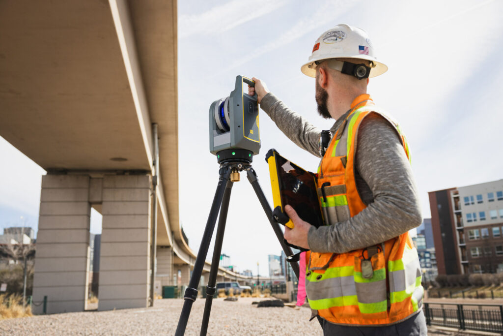
Avrocom Geo proudly delivers a wide range of innovative solutions from Trimble, a global leader in geospatial and construction technologies. These solutions include advanced GNSS systems, laser scanning equipment, and powerful software platforms that ensure centimeter‑level accuracy in surveying and mapping. Trimble technologies help specialists in construction, mining, agriculture, and infrastructure projects work more efficiently and safely. With real‑time data sharing and cloud connectivity, teams can collaborate seamlessly across different sites and projects. By integrating Trimble’s cutting‑edge tools, Avrocom Geo empowers customers in Tajikistan to reduce costs, improve productivity, and make smarter decisions. Our partnership with Trimble allows us to bring world‑class expertise and reliable instruments to the local market. Together, we provide professionals with the tools they need to build stronger projects and contribute to sustainable development.
Civil construction involves building schools, hospitals, office buildings, shopping centers, and other public facilities. Civil construction also plays a vital role in improving community infrastructure and enhancing quality of life.
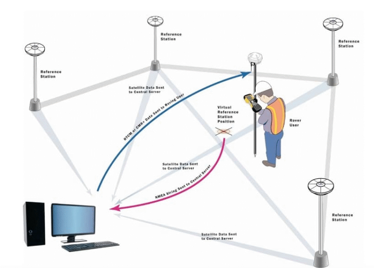
CORS (Continuously Operating Reference Stations) monitoring system is a network of permanent GNSS stations that provide precise positioning data in real time. It helps surveyors, engineers, and construction projects achieve centimeter-level accuracy for mapping and monitoring. Such systems are essential for infrastructure development, land management, and geodetic control.
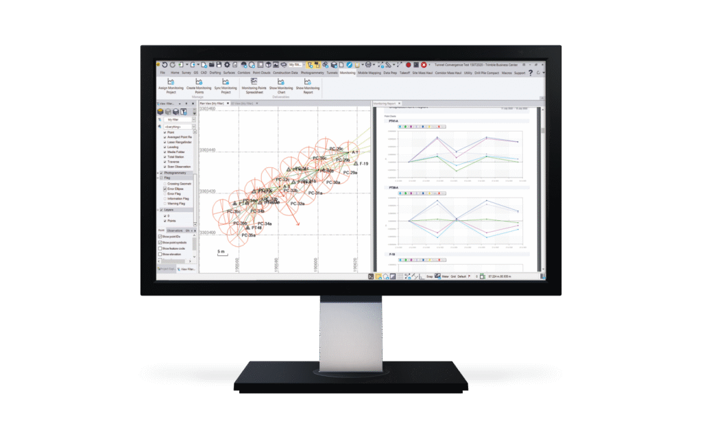
Monitoring systems for dams and similar structures use sensors and digital technologies to track stability and safety. They measure vibrations, water pressure, and structural changes, helping prevent accidents and ensuring reliable operation. Such systems are vital in seismically active regions and for protecting nearby communities.
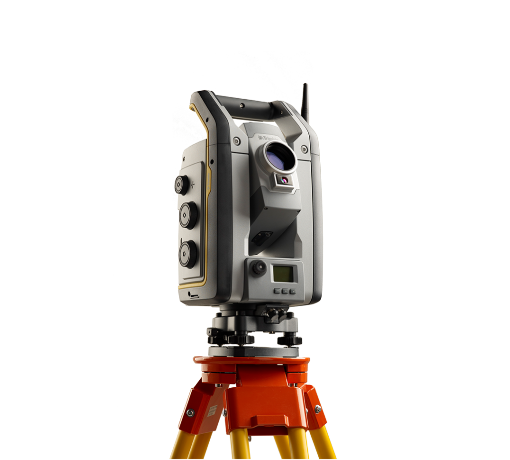
Trimble software provides advanced solutions for construction, agriculture, and geospatial industries. It integrates GPS, 3D modeling, and data management tools to improve accuracy, efficiency, and collaboration across projects. These systems help professionals keep projects on time, reduce costs, and make smarter decisions.
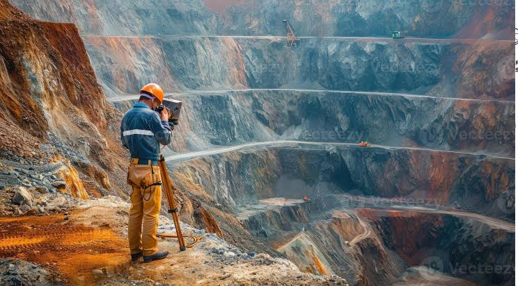
Trimble mining solutions help optimize resource extraction and improve safety across the entire mining lifecycle. They connect data from exploration, design, operations, and remediation into one system, providing real-time insights for better decision-making. This allows mining companies to increase productivity, reduce risk, and manage costs more effectively.
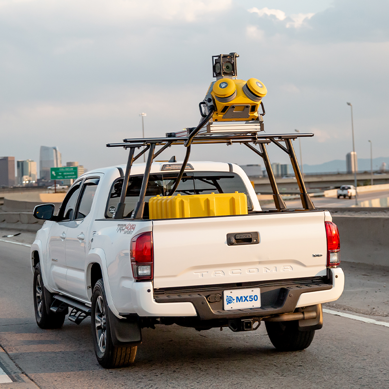
Road scanning and mapping systems use LiDAR sensors and cameras to create accurate 3D models of road surfaces. These maps help detect damage, improve maintenance, and support safe and efficient transportation planning.